
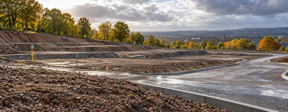
Land Surveys in Kidlington
Get in TouchAt Survium, we specialise in providing detailed land surveys across Kidlington and the surrounding OX5 2 postcode area. Our services cater to a wide range of projects, including residential, commercial and industrial developments.
Using advanced equipment and methods, we ensure precise measurements and comprehensive reports to support planning and construction processes.
What Is a Land Survey?
A land survey is a scientific method of measuring and mapping a plot of land. At Survium, we conduct these surveys in Kidlington to provide accurate data on land boundaries, topography, and existing structures.
Our surveys employ electronic distance measurement (EDM) equipment, total stations, and GPS technology, enabling us to achieve precise results. We cater to a range of property types, including residential, commercial, and industrial sites, addressing varied client needs.
Surveys like boundary surveys, topographic surveys, and site planning surveys, help in preparing for new developments or legal disputes.
These surveys are essential for property transactions, construction planning, and legal compliance, ensuring that all site aspects are well-documented and understood. We adhere to RICS standards, ensuring professional and reliable service.
Whether you are a developer, an architect, or a private landowner, our land surveys provide the detailed information necessary to support your project needs. Contact us today to schedule your land survey.
How Much Does a Land Survey Cost in Kidlington?
Land surveys typically cost between £400 and £1,500 in Kidlington, depending on the size and complexity of the site. Several factors influence the final price, including the type of survey required, such as topographical surveys, boundary surveys, or construction staking.
For larger properties or sites with challenging terrain, the use of specialised equipment like total stations and GPS units may be necessary, which can increase costs. Additionally, compliance with local regulations and standards, such as RICS guidelines, is essential and might affect pricing.
Surveying for commercial properties often involves more detailed analysis and data collection, potentially extending the duration of the project. Site accessibility issues, such as dense vegetation or issues accessing the site with vehicles, also play a role.
Contact us today to discuss your project requirements and obtain a precise quote.
Why Choose Survium for Land Surveys in Kidlington?
Choosing Survium for your land surveys in Kidlington ensures access to experienced professionals using state-of-the-art equipment. Our surveying services include a range of options, such as topographic surveys, boundary surveys, and construction staking.
We employ advanced techniques like LiDAR and GPS for precision mapping and use total stations and theodolites to ensure detailed measurements.
We prioritise accuracy and efficiency, providing comprehensive reports that meet legal and regulatory standards like RICS and ISO 9001. Our team works closely with property developers, construction companies, and architects to deliver quality service tailored to your specific project needs.
Whether it's a small residential plot or a large commercial development, we ensure each survey adheres to required timelines and budgets.
Contact us today to discuss how we can assist with your upcoming survey.
What Types of Land Surveys Are Available in Kidlington?
We offer various types of land surveys in Kidlington, covering a wide array of property and project needs:
Boundary Surveys: Define property lines accurately using total stations and GPS equipment, while locating existing encroachments. These are essential for property sales and resolving boundary disputes.
Topographical Surveys: Map out natural and man-made features of the land, providing elevation data crucial for planning and design processes. This involves using advanced lidar technology and drone surveys for detailed topographic models.
Construction Surveys: Guide construction projects by ensuring structures align with design specifications. We work closely with architects and contractors to lay out building footprints and reference points, adhering to precise tolerances required in the construction industry.
Subdivision Surveys: Plan and divide land into plots for development, ensuring compliance with local zoning laws and regulations. This often includes designing roads, implementing easements, and preparing plat maps for municipal approval.
Each type addresses specific requirements and project goals, ensuring all site elements are accounted for. Contact us to discuss your land survey needs and how we can assist with your project.
Speak to a Land Surveys Expert
How Does the Land Survey Process Work?
The land survey process includes several key steps:
Initial Consultation: We discuss your requirements and the scope of the survey, considering any pertinent land use regulations or zoning requirements that may apply.
Site Visit: Our team visits the location to gather all necessary measurements and data using tools like GPS receivers and total stations. We may also conduct topographic surveys to record elevation changes and boundary surveys to define property lines.
Data Analysis: We analyse the collected data using specialised software to create detailed maps and reports. Our analysis may include calculating land area, assessing terrain characteristics, or examining potential environmental impacts.
Report Delivery: We provide you with comprehensive documentation of the findings, including CAD drawings and legal descriptions, suitable for submission to planning authorities or use in property development.
This structured approach ensures accuracy and completeness in every survey we conduct and facilitates informed decision-making for land development and management.
Frequently Asked Questions
How often should a land survey be updated?
Land surveys should be updated whenever significant changes occur, such as construction or property sale, to ensure records remain accurate. In Kidlington, updates are recommended every five years for active developments.
What equipment is used in a land survey?
We use tools such as GPS units, total stations, and 3D laser scanners to ensure precise measurements and accurate data collection for all our surveys in Kidlington.
Are land surveys mandatory for property transactions?
In Kidlington, land surveys are often required for property transactions to verify boundaries and detect any encroachments, protecting both buyers and sellers and ensuring legal compliance.
Can a land survey determine the elevation of a site?
Yes, topographical land surveys conducted by Survium can determine site elevations, offering crucial information for planning and flood risk analysis in Kidlington.
Get a Free Quote for Land Surveys in Kidlington
For expert land surveying services in Kidlington, contact Survium today. Our team is ready to assist with all your surveying needs.
We cover Kidlington (Oxfordshire)