
PAS128 Utility Surveys in Bow
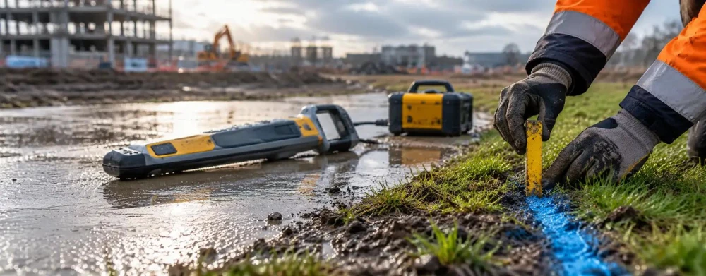
Get in TouchAt Survium, we specialise in providing PAS128 Utility Surveys to accurately map underground utilities in Bow. Our team uses advanced technologies like Ground Penetrating Radar (GPR) and Electromagnetic Locators (EML) to deliver precise results.
These surveys help in avoiding potential hazards during construction and development projects. We cover both urban and rural areas within the E3 5 postcode region, ensuring all your utility mapping needs are met.
What Is a PAS128 Utility Survey?
A PAS128 Utility Survey is a detailed investigation of underground utilities that follows the British standard PAS 128:2022 for utility detection, verification, and location. At Survium, we carry out these surveys in Bow to identify the location, depth, and type of utilities present.
Our methods include desktop studies, site reconnaissance, and the use of detection tools such as ground-penetrating radar (GPR), electromagnetic locators, and CCTV inspections to provide comprehensive utility mapping. These techniques allow us to identify utilities such as gas, water, electricity, and telecommunications, both metallic and non-metallic, and comply with the latest safety standards.
Understanding the precise location of utilities is crucial for construction planning, minimising risks of utility strikes and ensuring project timelines stay on track. With our detailed surveys, clients can confidently proceed with excavation and construction, reducing the likelihood of costly delays and safety hazards.
How Much Does a PAS128 Utility Survey Cost in Bow?
PAS128 Utility Surveys typically cost between £700 to £1,500 per site in Bow. The cost depends on factors such as site size, complexity, and location within the E3 5 area.
Factors like terrain type and depth of utilities can also influence the cost, as certain situations may require more specialised techniques such as ground-penetrating radar (GPR) or electromagnetic location (EML).
Our surveys adhere to all PAS128:2014 specification guidelines, ensuring precision in detecting both underground and overhead utilities, including gas lines, water pipes, and electrical cables. In urban areas, where utility congestion is common, additional time may be required for accurate mapping, which can adjust the final cost.
Larger sites or areas with dense utility networks may incur higher costs due to the detailed work required. We can provide surveys for a wide range of properties, including commercial buildings, residential developments, and public infrastructure projects.
Contact us for an accurate quote specific to your needs.
Book PAS128 Utility Surveys Today
Why Choose Survium for PAS128 Utility Surveys in Bow?
Choosing Survium for your PAS128 Utility Surveys in Bow ensures accuracy and reliability. Our experienced team uses state-of-the-art equipment, including Ground Penetrating Radar (GPR) and Electromagnetic Location (EML), to provide comprehensive surveys.
We adhere to the PAS128 standards, ensuring that all our surveys are performed with precision and meet industry benchmarks. Our service covers all quality levels from QL-D to QL-A, ensuring thoroughness based on the project's complexity.
We incorporate advanced software to analyse and interpret data, providing detailed 3D models and CAD drawings for better visualisation and planning. Our surveys identify underground utilities like gas, water, electricity, and telecommunications, crucial for construction, engineering, and infrastructure projects.
We also offer prompt turnaround times, usually completing surveys within two to three days. We tailor our services to meet the specific requirements of your project.
Get in touch with us today to discuss your utility mapping needs.
What Types of PAS128 Utility Surveys Are Available in Bow?
We offer several types of PAS128 Utility Surveys in Bow, each designed to meet specific surveying needs and compliance standards associated with construction and development projects.
Basic Desktop Study: This involves the initial gathering of existing utility records and geographic information system (GIS) data, helping to build a preliminary picture of subsurface conditions.
Site Reconnaissance: A visual inspection is conducted following the desktop study to confirm and supplement initial findings. Our surveyors use this opportunity to assess site conditions and accessibility for further investigations.
Detection Surveys: Using Ground Penetrating Radar (GPR) and Electromagnetic Location (EML) techniques, we accurately locate underground utilities such as cables, pipes, and sewers. The data collected is crucial in planning excavation work and ensuring safety.
Verification Surveys: These involve physical confirmation, typically through trial holes or potholing, to ensure the precise location and depth of the utilities identified in the detection surveys.
Each type serves specific purposes and contributes to a thorough understanding of subterranean utilities, supporting safe and efficient project execution. Contact us to determine the most suitable survey for your needs.
What Are the Benefits of PAS128 Utility Surveys in Bow?
PAS128 Utility Surveys provide several benefits in Bow by adhering to established practices that ensure safe and efficient project outcomes:
Risk Mitigation: Using advanced technologies such as Ground Penetrating Radar (GPR) and Radio Frequency Identification (RFID), we significantly reduce the chance of damaging underground utilities like water pipes, gas lines and electrical cables.
Cost Efficiency: By preventing costly delays and repairs typically associated with utility strikes, our surveys offer a return on investment by ensuring uninterrupted progress. Early identification of potential conflicts can save thousands in unforeseen costs.
Comprehensive Data: Our surveys include detailed mapping of all utilities, with the data presented using Geo-referenced CAD and BIM files. This facilitates seamless integration into existing project management systems.
Project Success: Assists in precise planning and execution by providing accurate utility location data, which supports compliance with standards such as BSI PAS128 and ensures all stakeholders coordinate effectively.
Contact us today for a quote on securing these advantages for your project.
Speak to a PAS128 Utility Surveys Expert
Frequently Asked Questions
What is included in a PAS128 Utility Survey?
A PAS128 Utility Survey from Survium includes a desktop study, site inspection, and the use of detection equipment to accurately map utilities.
How long does a PAS128 Utility Survey take?
Typically, a survey takes two to three days depending on the complexity and size of the site.
Is a PAS128 Utility Survey necessary for all projects?
While not mandatory, a PAS128 Utility Survey is recommended for any construction project in E3 5 to avoid costly utility strikes.
What equipment is used in a PAS128 Utility Survey?
We use Ground Penetrating Radar and Electromagnetic Locators, ensuring accurate detection and mapping of underground utilities.
Can PAS128 Utility Surveys detect all types of utilities?
Yes, our PAS128 surveys can detect a range of utilities, including water, gas, electricity, and telecommunications.
Get a Free Quote for PAS128 Utility Surveys in Bow
Contact Survium today to arrange your PAS128 Utility Survey in Bow. Our expert team is ready to provide a detailed and reliable survey for your project.
We cover Bow (Greater London)